The Verdon Gorge: Rim Roads, the Lake, and the Blanc-Martel Trail
The Verdon Gorge is the one place in Provence that looks nothing like the rest of Provence. The river runs jade green between limestone walls up to about 700 meters high, the deepest section stretches roughly 25 km, and the whole thing empties into the turquoise Lac de Sainte-Croix. People call it the Grand Canyon of Europe, and for once the nickname undersells the color. The catch is distance: the gorge sits about an hour and a half from Aix-en-Provence and two hours from Avignon, so it does not tack onto a village-hopping day. Give it a full day at minimum; a night out there beats the drive back.
The Two Rim Roads
Two roads run the rims. The D952 follows the north bank between Castellane and Moustiers-Sainte-Marie, passing the Point Sublime at Rougon, the single best overlook of the canyon. The Corniche Sublime traces the south bank from Aiguines toward Comps-sur-Artuby, crossing the Pont de l’Artuby high over a side canyon. Off the north road, the Route des Crêtes loops out of La Palud-sur-Verdon past a string of belvederes hanging over the void; part of the loop runs one-way, so follow the signed direction from La Palud, and the high section closes in winter. Drivers pick a bank per day: start from Aiguines in the morning with the sun behind you, or run the Crêtes late for the evening light.
The Lake and the Pont du Galetas
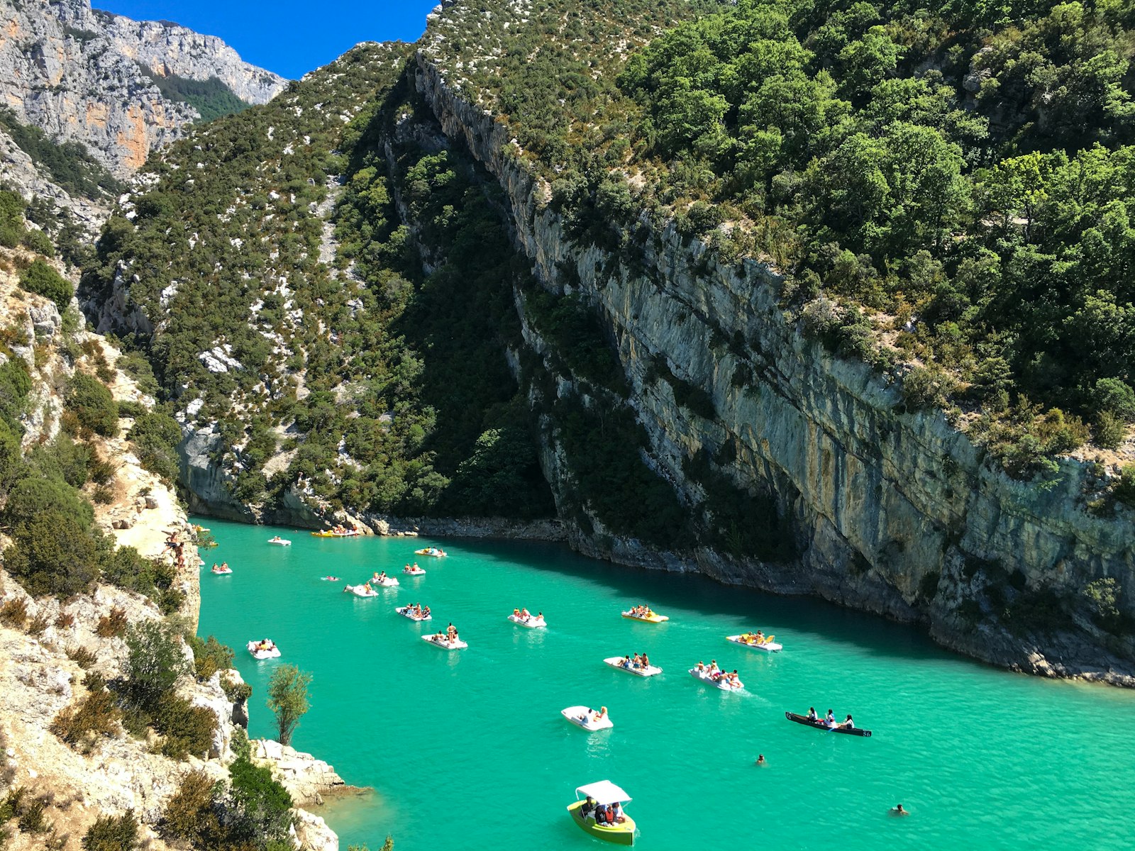
Where the river meets the Lac de Sainte-Croix, the Pont du Galetas bridge frames the postcard view: turquoise water disappearing between the cliffs. Rental bases on the beaches by the bridge hire out pedalos, kayaks, and paddleboards, and the ride into the canyon mouth takes one to two hours round trip, which is the cheapest great experience in the region. In July and August, arrive in the morning; the beach car parks fill by midday. The lake itself has swimming beaches at Les Salles-sur-Verdon, Bauduen, and Sainte-Croix-du-Verdon, with water warm enough to stay in by mid-summer.
The Blanc-Martel Trail
The famous hike runs about 15 to 16 km one way along the canyon floor between the Chalet de la Maline and the Point Sublime. Allow six to seven hours of walking, carry a real flashlight for the tunnels near the end, and expect the metal ladders of the Brèche Imbert partway through. The trail is point-to-point, and a seasonal shuttle links the two ends, so check the current timetable before committing to the direction. Two rules keep the day safe: the river level is dam-controlled and can rise without warning, so swim at the lake rather than in the gorge, and skip the route entirely if exposed drops bother you. The shorter Sentier de l’Imbut and the easy walk near the Galetas cover the same scenery at two very different levels of effort.
Moustiers and Aiguines
Moustiers-Sainte-Marie, one of the official Plus Beaux Villages de France, hangs on a cliff at the western gate of the gorge, with faience workshops that have fired ceramics since the 17th century, the Notre-Dame de Beauvoir chapel up its stone path, a gilded star suspended on a chain between two crags, and a Friday market. Aiguines, smaller and quieter, sits above the lake at the start of the Corniche Sublime with a wide view down over the lake. Both work as the overnight base; both appear in the Provence villages guide.
Fitting the Verdon into a Provence Trip
Public transport barely touches the gorge, so this is car country. From Aix, count about an hour and a half each way; from Avignon or Arles, closer to two hours. The one pairing that genuinely works is lavender: the Valensole plateau lies on the road in from the west, so from late June to mid-July a morning in the lavender rows and an afternoon on the lake make the best single day in Haute-Provence. Outside lavender season, treat the Verdon as its own destination: drive out, sleep in Moustiers or Aiguines, and give the gorge the daylight it needs.
Frequently Asked Questions
How deep is the Verdon Gorge?
The limestone walls rise up to about 700 meters above the river, and the deepest, most dramatic section runs roughly 25 km between Castellane and the Lac de Sainte-Croix.
Can you swim in the Verdon Gorge?
Swim in the Lac de Sainte-Croix, which has beaches at Les Salles-sur-Verdon, Bauduen, and Sainte-Croix-du-Verdon. The river inside the canyon is dam-controlled and can rise without warning, so stay out of it.
Do you need a car for the Verdon Gorge?
In practice, yes. Public transport barely reaches the gorge, and the rim roads, the lake beaches, and the trailheads sit far apart. Count about 1.5 hours of driving from Aix-en-Provence and 2 from Avignon.
What is the best single viewpoint?
The Point Sublime at Rougon for the canyon itself, and the Pont du Galetas for the postcard of turquoise water between the cliffs. The Route des Crêtes belvederes sit between the two in both distance and drama.
How much time does the Verdon Gorge need?
One full day covers a rim road plus an hour or two on the water at the Galetas. Add a night in Moustiers-Sainte-Marie or Aiguines to walk the Blanc-Martel trail or drive both rims without watching the clock.